
Dennis topographic map
Click on the map to display elevation.
About this map
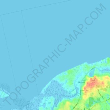
Name: Dennis topographic map, elevation, terrain.
Location: Dennis, Barnstable County, Massachusetts, United States (41.71265 -70.26011 41.80254 -70.16824)
Average elevation: 10 ft
Minimum elevation: -10 ft
Maximum elevation: 144 ft
Barnstable County trails, hiking, mountain biking, running and outdoor activities
Other topographic maps
Click on a map to view its topography, its elevation and its terrain.