Geolocate

Colu topographic map

Click on the map to display elevation.

About this map

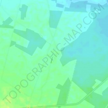
Name: Colu topographic map, elevation, terrain.

Location: Colu, María la Baja, Dique, Bolívar, RAP Caribe, Colombia (9.91478 -75.35537 9.93478 -75.33537)

Average elevation: 49 ft

Minimum elevation: 26 ft

Maximum elevation: 75 ft

Gear up for your next adventure:

🪶Survival Guide Book - Expert advice for emergency preparedness
🥾Hiking Shoes - Durable and comfortable shoes for trail hiking
🥄Camping Utensil Set - Lightweight utensils for outdoor meals
📶Vehicle Signal Boosters - Improve reception in rural areas while driving to trailheads
🗻Climbing Gear Basics - Essential gear for beginner climbers

As an Amazon Associate, this site earns from qualifying purchases at no extra cost to you.