Geolocate

Dock Junction topographic map

Click on the map to display elevation.

About this map
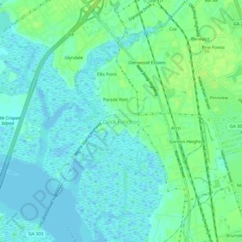
Name: Dock Junction topographic map, elevation, terrain.

Location: Dock Junction, Glynn County, Georgia, 31521, United States (31.18245 -81.53677 31.22245 -81.49677)

Average elevation: 16 ft

Minimum elevation: -10 ft

Maximum elevation: 39 ft

Georgia trails, hiking, mountain biking, running and outdoor activities

Gear up for your next adventure:

🖼️Topo Map Wall Art - Decorative topographic prints of famous peaks and regions
🥇GPS Hiking Watch - Multi‑sport GPS watch with navigation and trail tracking
🦺Reflective Outdoor Gear - Safety gear for low‑light conditions
🪑Portable Camp Table - Compact table for campsite meals
🌲Outdoor Survival Books - Best books on survival skills

As an Amazon Associate, this site earns from qualifying purchases at no extra cost to you.