
Pictou Island topographic map
Interactive map
Click on the map to display elevation.
About this map
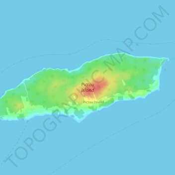
Name: Pictou Island topographic map, elevation, terrain.
Average elevation: 13 ft
Minimum elevation: 0 ft
Maximum elevation: 161 ft
Pictou Island is a Canadian island located in the Northumberland Strait approximately 4 NM north of Nova Scotia and 10 NM south of Prince Edward Island. Measuring 9.5 km in length and 2.5 km in width, the total area is 23.75 km2. The island is administratively part of Pictou County. The island's highest elevation is 24 meters (78 feet) above sea level, and its current full-time residents population (as of 2016) stands at 28, with the seasonal population rising and lowering.