
Union Pier topographic map
Click on the map to display elevation.
About this map
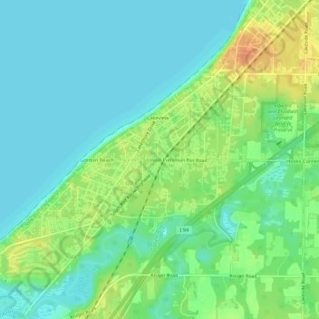
Name: Union Pier topographic map, elevation, terrain.
Average elevation: 614 ft
Minimum elevation: 571 ft
Maximum elevation: 692 ft
Berrien County trails, hiking, mountain biking, running and outdoor activities
Other topographic maps
Click on a map to view its topography, its elevation and its terrain.
Grand Beach
United States > Michigan > Berrien County > New Buffalo Township
Average elevation: 600 ft