Geolocate

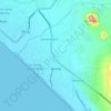
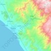
El Milagro topographic map

Click on the map to display elevation.

About this map

Name: El Milagro topographic map, elevation, terrain.

Location: El Milagro, Huanchaco, Province of Trujillo, La Libertad, Peru (-8.07383 -79.10316 -7.99383 -79.02316)

Average elevation: 495 ft

Minimum elevation: 118 ft

Maximum elevation: 2,126 ft

Other topographic maps

Click on a map to view its topography, its elevation and its terrain.
Province of Chepén

Peru > La Libertad

Average elevation: 722 ft

La Esperanza

Peru > La Libertad

Average elevation: 367 ft

Province of Chepén

Peru > La Libertad

Average elevation: 722 ft

Víctor Larco Herrera

Peru > La Libertad

Average elevation: 33 ft

Poroto

Peru > La Libertad

Average elevation: 3,832 ft

Guadalupito

Peru > La Libertad

Average elevation: 551 ft

Trujillo

Peru > La Libertad

Average elevation: 121 ft

Chicama

Peru > La Libertad

Average elevation: 2,388 ft

Moche

Peru > La Libertad

Average elevation: 102 ft

Chan Chan Archaeological Zone

Peru > La Libertad > Huanchaco

The archaeological site at Chan Chan is under constant and severe threat of ruin from weathering. Several archaeologists, conservationists, and an array of institutions are working to survey the architecture existing there. Different methods of survey can be utilized but any methodology must be both quick…

Average elevation: 82 ft
Chao

Peru > La Libertad

Average elevation: 1,404 ft

Huancaspata

Peru > La Libertad

Average elevation: 10,377 ft

Simbal

Peru > La Libertad

Average elevation: 5,358 ft

Province of Trujillo

Peru > La Libertad

Average elevation: 3,196 ft

Trujillo

Peru > La Libertad

Average elevation: 121 ft

Magdalena de Cao

Peru > La Libertad

Average elevation: 112 ft

El Porvenir

Peru > La Libertad > El Porvenir

Average elevation: 774 ft

Laredo

Peru > La Libertad > Laredo

Average elevation: 1,388 ft

Gear up for your next adventure:

🏥Hiking First Aid Kits - Comprehensive medical kits for remote trail injuries
☀️Outdoor Sunscreen - High protection sunscreen for outdoor activities
🧤Tactile Hiking Gloves - Keep hands warm while operating GPS and smartphone screens
🗺️NatGeo Topo Maps - High-quality waterproof printed topographic maps of US Parks
☕Camping Coffee Makers - Enjoy premium coffee at the summit or campsite

As an Amazon Associate, this site earns from qualifying purchases at no extra cost to you.