
Dondeneville topographic map
Interactive map
Click on the map to display elevation.
About this map
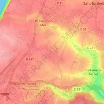
Name: Dondeneville topographic map, elevation, terrain.
Average elevation: 249 ft
Minimum elevation: 0 ft
Maximum elevation: 328 ft
Other topographic maps
Click on a map to view its topography, its elevation and its terrain.
Le Moulin
France > Normandie > Seine-Maritime > Octeville-sur-Mer > Le Moulin
Le Moulin, Octeville-sur-Mer, Le Havre, Seine-Maritime, Normandie, France métropolitaine, 76930, France
Average elevation: 223 ft