

Rio de Janeiro topographic map
Click on the map to display elevation.
About this map

Name: Rio de Janeiro topographic map, elevation, terrain.
Location: Rio de Janeiro, Southeast Region, Brazil (-24.87528 -45.01942 -19.67528 -39.81942)
Average elevation: 1,047 ft
Minimum elevation: -7 ft
Maximum elevation: 8,645 ft
Other topographic maps
Click on a map to view its topography, its elevation and its terrain.
Barra da Tijuca
Brazil > Rio de Janeiro > Região Metropolitana do Rio de Janeiro > Rio de Janeiro
Average elevation: 13 ft

Recreio dos Bandeirantes
Brazil > Rio de Janeiro > Região Metropolitana do Rio de Janeiro > Rio de Janeiro
Average elevation: 161 ft

Manilha
Brazil > Rio de Janeiro > Região Metropolitana do Rio de Janeiro > Itaboraí
Average elevation: 102 ft
Copacabana
Brazil > Rio de Janeiro > Região Metropolitana do Rio de Janeiro > Rio de Janeiro
Average elevation: 135 ft

Parque Eduardo Guinle
Brazil > Rio de Janeiro > Região Metropolitana do Rio de Janeiro > Rio de Janeiro
Average elevation: 171 ft

Região Norte
Brazil > Rio de Janeiro > Região Metropolitana do Rio de Janeiro > Niterói
Average elevation: 177 ft
Rocinha
Brazil > Rio de Janeiro > Região Metropolitana do Rio de Janeiro > Rio de Janeiro
Average elevation: 528 ft

Nova Iguaçu
Brazil > Rio de Janeiro > Região Metropolitana do Rio de Janeiro
Average elevation: 535 ft
Rio Cuiabá
Brazil > Rio de Janeiro > Região Metropolitana do Rio de Janeiro > Petrópolis
Average elevation: 3,038 ft
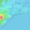
Praia do Leblon
Brazil > Rio de Janeiro > Região Metropolitana do Rio de Janeiro > Rio de Janeiro
Average elevation: 85 ft


Tanque
Brazil > Rio de Janeiro > Região Metropolitana do Rio de Janeiro > Rio de Janeiro
Average elevation: 259 ft

Campos Elyseos
Brazil > Rio de Janeiro > Região Metropolitana do Rio de Janeiro > Duque de Caxias
Average elevation: 23 ft
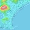
Copacabana Beach
Brazil > Rio de Janeiro > Região Metropolitana do Rio de Janeiro > Rio de Janeiro
Average elevation: 125 ft

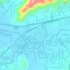
Praça Jamal de Paula
Brazil > Rio de Janeiro > Região Metropolitana do Rio de Janeiro > Rio de Janeiro
Average elevation: 92 ft
