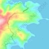
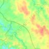
Bitung topographic map
Click on the map to display elevation.
About this map

Name: Bitung topographic map, elevation, terrain.
Location: Bitung, North Sulawesi, Sulawesi, Indonesia (1.38712 125.03249 1.59996 125.29618)
Average elevation: 390 ft
Minimum elevation: 0 ft
Maximum elevation: 4,295 ft
Other topographic maps
Click on a map to view its topography, its elevation and its terrain.


Tondano
Tondano has an elevation moderated tropical rainforest climate (Af) with moderate rainfall from July to September and heavy rainfall in the remaining months.
Average elevation: 2,431 ft


Mount Ruang
Indonesia > North Sulawesi > Kepulauan Siau Tagulandang Biaro > Pumpente
Ruang is the southernmost stratovolcano in the Sangihe Islands arc, North Sulawesi, Indonesia. It comprises an island 4 by 5 kilometres (2.5 mi × 3.1 mi) wide. The summit contains a partial lava dome and reaches some 725 metres (2,379 ft) in altitude. From its summit, Klabat's peak in the south, that of Siau…
Average elevation: 945 ft




Tondano
Tondano has an elevation moderated tropical rainforest climate (Af) with moderate rainfall from July to September and heavy rainfall in the remaining months.
Average elevation: 2,431 ft

Tondano
Tondano has an elevation moderated tropical rainforest climate (Af) with moderate rainfall from July to September and heavy rainfall in the remaining months.
Average elevation: 2,431 ft