
Thank you for supporting this site ❤️
Make a donation
Make a donation
Gear up for your next adventure:
As an Amazon Associate, this site earns from qualifying purchases at no extra cost to you.
Pillcopata topographic map
Click on the map to display elevation.
Thank you for supporting this site ❤️
Make a donation
Make a donation
Gear up for your next adventure:
As an Amazon Associate, this site earns from qualifying purchases at no extra cost to you.
About this map
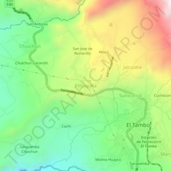
Name: Pillcopata topographic map, elevation, terrain.
Location: Pillcopata, El Tambo, Cañar, 030202, Ecuador (-2.52088 -78.95924 -2.48088 -78.91924)
Average elevation: 9,885 ft
Minimum elevation: 8,750 ft
Maximum elevation: 11,614 ft
Thank you for supporting this site ❤️
Make a donation
Make a donation
Gear up for your next adventure:
As an Amazon Associate, this site earns from qualifying purchases at no extra cost to you.