Geolocate

Highmore topographic map

Click on the map to display elevation.

Highmore

A post office called Highmore has been in operation since 1882. The city was named from its lofty elevation.

Wikipedia (CC-BY-SA 3.0)

About this map

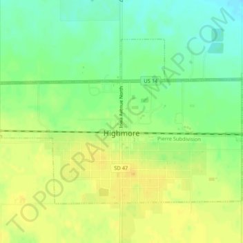
Name: Highmore topographic map, elevation, terrain.

Location: Highmore, Hyde County, South Dakota, United States (44.51294 -99.46187 44.53255 -99.42134)

Average elevation: 1,880 ft

Minimum elevation: 1,831 ft

Maximum elevation: 1,916 ft

Hyde County trails, hiking, mountain biking, running and outdoor activities

Gear up for your next adventure:

🪄Magnetic Compass - Accurate compass for navigation
🧢Sun Protection Hats - Wide-brimmed and UPF-rated hats for high-altitude sun safety
🎒Trekking Poles - Sturdy poles for balance and stability on rough terrain
🪵Folding Camp Saw - Compact saw for wood and campsite work
🔥Fast-Boil Camping Stoves - Efficient cooking systems for quick trail meals

As an Amazon Associate, this site earns from qualifying purchases at no extra cost to you.