
Make a donation
Gear up for your next adventure:
As an Amazon Associate, this site earns from qualifying purchases at no extra cost to you.
Lozen Boer topographic map
Click on the map to display elevation.
Make a donation
Gear up for your next adventure:
As an Amazon Associate, this site earns from qualifying purchases at no extra cost to you.
About this map
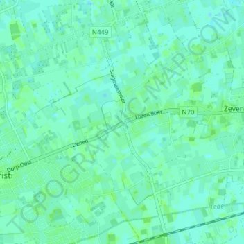
Name: Lozen Boer topographic map, elevation, terrain.
Location: Lozen Boer, Lochristi, Gent, Oost-Vlaanderen, 9080, België (51.08568 3.84854 51.12568 3.88854)
Average elevation: 16 ft
Minimum elevation: 7 ft
Maximum elevation: 26 ft
Make a donation
Gear up for your next adventure:
As an Amazon Associate, this site earns from qualifying purchases at no extra cost to you.
Other topographic maps
Click on a map to view its topography, its elevation and its terrain.
Wachtebeke
België > Oost-Vlaanderen > Gent > Lochristi
Wachtebeke ligt in Zandig Vlaanderen op een hoogte van 4 tot 7 meter. Ten zuiden van de kern ligt de Moervaartdepressie tussen de Moervaart in het noorden en de Zuidlede in het zuiden. Ook vindt men daar het Provinciaal Domein Puyenbroeck. In het noordoosten ligt het Heidebos terwijl in het noordwesten het…
Average elevation: 13 ft