Geolocate

Jonancy topographic map

Click on the map to display elevation.

About this map
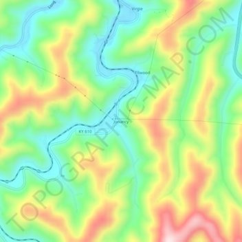
Name: Jonancy topographic map, elevation, terrain.

Location: Jonancy, Pike County, Kentucky, 41538, United States (37.29649 -82.60293 37.33649 -82.56293)

Average elevation: 1,309 ft

Minimum elevation: 830 ft

Maximum elevation: 2,031 ft

Pike County trails, hiking, mountain biking, running and outdoor activities

Gear up for your next adventure:

🧦Hiking Socks - Comfortable socks to prevent blisters on long hikes
🦟Ultrasonic Repellers - Create a bug-free zone at your camp or rest stop
🧢Outdoor Hiking Hat - Sun protection hat for outdoor explorers
🎒Waterproof Dry Bags - Keep your electronics and maps dry inside your pack
🧤Hiking Gloves - Protective gloves for rugged trails

As an Amazon Associate, this site earns from qualifying purchases at no extra cost to you.