Geolocate

Hovden topographic map

Click on the map to display elevation.

About this map
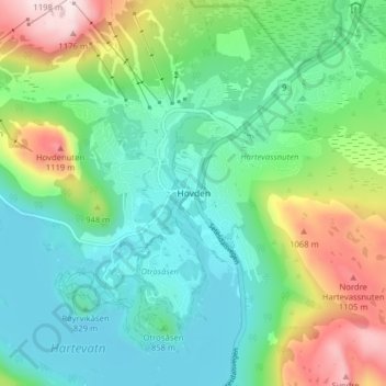
Name: Hovden topographic map, elevation, terrain.

Location: Hovden, Bykle, Agder, 4755, Norway (59.54024 7.33602 59.58024 7.37602)

Average elevation: 2,871 ft

Minimum elevation: 2,461 ft

Maximum elevation: 3,885 ft

Gear up for your next adventure:

⛺Backpacking Tent - Lightweight and durable tent for multi‑day hikes
🥾Men's Hiking Boots - Durable, waterproof footwear for rugged terrain and steep inclines
🚑Emergency Bivvies - Heat-reflective sleeping bags for survival situations
🎒Waterproof Dry Bags - Keep your electronics and maps dry inside your pack
🥾Hiking Shoes - Durable and comfortable shoes for trail hiking

As an Amazon Associate, this site earns from qualifying purchases at no extra cost to you.