
Make a donation
Gear up for your next adventure:
As an Amazon Associate, this site earns from qualifying purchases at no extra cost to you.
Tanjung Ketapang topographic map
Click on the map to display elevation.
Make a donation
Gear up for your next adventure:
As an Amazon Associate, this site earns from qualifying purchases at no extra cost to you.
About this map
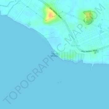
Name: Tanjung Ketapang topographic map, elevation, terrain.
Average elevation: 10 ft
Minimum elevation: 0 ft
Maximum elevation: 118 ft
Make a donation
Gear up for your next adventure:
As an Amazon Associate, this site earns from qualifying purchases at no extra cost to you.
Other topographic maps
Click on a map to view its topography, its elevation and its terrain.
Upeh Island
Malaysia > Malacca > Malacca City
The state of Malacca covers an area of 1,775 km2 (685 sq mi). It located on the southwestern coast of the Malay Peninsula opposite Sumatra, with the state of Negeri Sembilan to the north and west and Johor to the east. Malacca is situated roughly two-thirds of the way down the west coast, 149 km (93 mi) south…
Average elevation: 0 ft
Make a donation
Gear up for your next adventure:
As an Amazon Associate, this site earns from qualifying purchases at no extra cost to you.
Make a donation
Gear up for your next adventure:
As an Amazon Associate, this site earns from qualifying purchases at no extra cost to you.