Geolocate

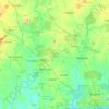
Nigui Saff topographic map

Click on the map to display elevation.

About this map

Name: Nigui Saff topographic map, elevation, terrain.

Location: Nigui Saff, Grands-Ponts, Lagunes, Côte d’Ivoire (5.22750 -4.63528 5.26750 -4.59528)

Average elevation: 20 ft

Minimum elevation: -10 ft

Maximum elevation: 194 ft

Other topographic maps

Click on a map to view its topography, its elevation and its terrain.

Agnéby-Tiassa

Côte d’Ivoire > Lagunes

Average elevation: 272 ft

Sikensi

Côte d’Ivoire > Lagunes

Average elevation: 246 ft

Bandama

Côte d’Ivoire > Lagunes

Average elevation: 374 ft

Lagune Potou

Côte d’Ivoire > Lagunes > Oguédoume

Average elevation: 49 ft

Bacanda

Côte d’Ivoire > Lagunes

Average elevation: 108 ft

Gear up for your next adventure:

🏕️Family Camping Gear - Essentials for group camping trips
🧭Outdoor Navigation Book - Learn advanced navigation skills
🥇GPS Hiking Watch - Multi‑sport GPS watch with navigation and trail tracking
📶Satellite Messenger - Communication device off‑grid
🛠️Backpacking Tool Kit - Essential toolkit for outdoor repairs

As an Amazon Associate, this site earns from qualifying purchases at no extra cost to you.