
Assureti topographic map
Click on the map to display elevation.
About this map
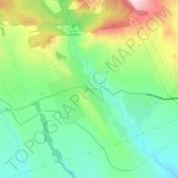
Name: Assureti topographic map, elevation, terrain.
Location: Assureti, Tetritskaro Municipality, Lower Kartli, Georgia (41.57341 44.65026 41.61341 44.69026)
Average elevation: 2,484 ft
Minimum elevation: 1,936 ft
Maximum elevation: 3,501 ft
Other topographic maps
Click on a map to view its topography, its elevation and its terrain.
Algeti Reservoir
Georgia > Lower Kartli > Tetritskaro Municipality > Tbisi
Average elevation: 2,851 ft
Tetritskaro
Georgia > Lower Kartli > Tetritskaro Municipality > Tetritskaro
Average elevation: 3,812 ft