
Montevideo topographic map
Interactive map
Click on the map to display elevation.
About this map
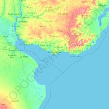
Name: Montevideo topographic map, elevation, terrain.
Location: Montevideo, Uruguay (-37.46527 -58.78195 -32.26527 -53.58195)
Average elevation: 131 ft
Minimum elevation: -13 ft
Maximum elevation: 1,545 ft
Other topographic maps
Click on a map to view its topography, its elevation and its terrain.