
柳梧街道 topographic map
Interactive map
Click on the map to display elevation.
About this map
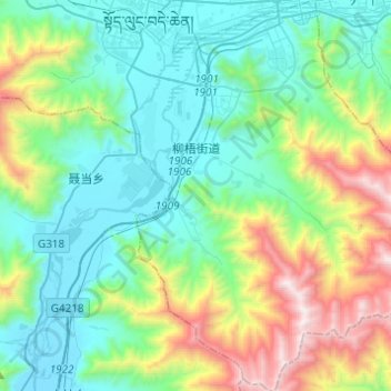
Name: 柳梧街道 topographic map, elevation, terrain.
Location: 柳梧街道, 堆龙德庆区 སྟོད་ལུང་བདེ་ཆེན་ཆུས།, Lhassa, Tibet, Chine (29.43444 90.99403 29.64766 91.17416)
Average elevation: 13,396 ft
Minimum elevation: 11,811 ft
Maximum elevation: 18,074 ft
Other topographic maps
Click on a map to view its topography, its elevation and its terrain.