Geolocate

Jelendol topographic map

Click on the map to display elevation.

About this map

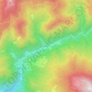
Name: Jelendol topographic map, elevation, terrain.

Location: Jelendol, Tržič, Slovenia (46.37906 14.32648 46.41906 14.36648)

Average elevation: 3,540 ft

Minimum elevation: 1,919 ft

Maximum elevation: 5,243 ft

Gear up for your next adventure:

🪄Magnetic Compass - Accurate compass for navigation
📱Heavy-Duty Phone Cases - Drop-proof and waterproof protection for outdoor navigation
🎒Day Hiking Backpack - Lightweight backpack perfect for day trips and outdoor adventures
😴Insulated Sleeping Pads - Compact and warm pads for high-elevation camping
🎒Gear Packing Cubes - Organize your backpack efficiently

As an Amazon Associate, this site earns from qualifying purchases at no extra cost to you.