
Thank you for supporting this site ❤️
Make a donation
Make a donation
Gear up for your next adventure:
As an Amazon Associate, this site earns from qualifying purchases at no extra cost to you.
Jayawijaya topographic map
Click on the map to display elevation.
Thank you for supporting this site ❤️
Make a donation
Make a donation
Gear up for your next adventure:
As an Amazon Associate, this site earns from qualifying purchases at no extra cost to you.
About this map
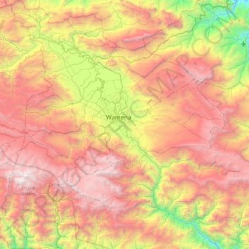
Name: Jayawijaya topographic map, elevation, terrain.
Location: Jayawijaya, Highland Papua, Western New Guinea, Indonesia (-4.47843 138.58310 -3.75421 139.25725)
Average elevation: 8,100 ft
Minimum elevation: 1,604 ft
Maximum elevation: 14,865 ft
Thank you for supporting this site ❤️
Make a donation
Make a donation
Gear up for your next adventure:
As an Amazon Associate, this site earns from qualifying purchases at no extra cost to you.