
Thank you for supporting this site ❤️
Make a donation
Make a donation
Gear up for your next adventure:
As an Amazon Associate, this site earns from qualifying purchases at no extra cost to you.
Gironico topographic map
Click on the map to display elevation.
Thank you for supporting this site ❤️
Make a donation
Make a donation
Gear up for your next adventure:
As an Amazon Associate, this site earns from qualifying purchases at no extra cost to you.
About this map
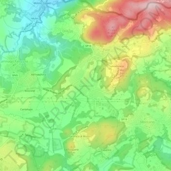
Name: Gironico topographic map, elevation, terrain.
Location: Gironico, Colverde, Como, Lombardia, 22041, Italia (45.78246 8.98078 45.82246 9.02078)
Average elevation: 1,263 ft
Minimum elevation: 869 ft
Maximum elevation: 1,850 ft
Thank you for supporting this site ❤️
Make a donation
Make a donation
Gear up for your next adventure:
As an Amazon Associate, this site earns from qualifying purchases at no extra cost to you.