Geolocate

Mattul topographic map

Click on the map to display elevation.

About this map

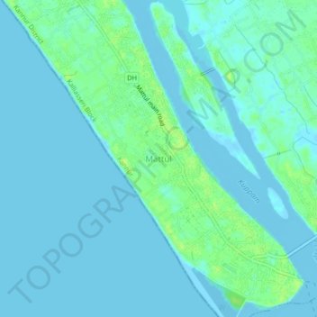
Name: Mattul topographic map, elevation, terrain.

Location: Mattul, Kalliasseri Block, Kannur, Kannur District, Kerala, 670302, India (11.94728 75.26600 11.98728 75.30600)

Average elevation: 10 ft

Minimum elevation: -10 ft

Maximum elevation: 43 ft

Other topographic maps

Click on a map to view its topography, its elevation and its terrain.

Pallikunnu

India > Kerala > Kannur

Average elevation: 46 ft

Kannur

India > Kerala > Kannur

Kannur has an elevation of 1.02 metres or 3.3 feet along the coast of the Laccadive Sea, with a sandy coastal area. The city has an 8 kilometres (5.0 mi)-long seashore and a 3 kilometres (1.9 mi)-long beach at Payyambalam. Kannur is located north of Kozhikode, south of Kasargod and Mangalore, west of the…

Average elevation: 46 ft

Chakkarakal

India > Kerala > Kannur > Movancherry > Kavinmoola

Average elevation: 115 ft

Peralassery

India > Kerala > Kannur > Kadachira

Average elevation: 69 ft

Eachur

India > Kerala > Kannur > Kanachery

Average elevation: 89 ft

Puzhathi

India > Kerala > Kannur

Average elevation: 62 ft

Thana

India > Kerala > Kannur > Kannur

Average elevation: 66 ft

Kannur

India > Kerala > Kannur

Kannur has an elevation of 1.02 metres or 3.3 feet along the coast of the Laccadive Sea, with a sandy coastal area. The city has an 8 kilometres (5.0 mi)-long seashore and a 3 kilometres (1.9 mi)-long beach at Payyambalam. Kannur is located north of Kozhikode, south of Kasargod and Mangalore, west of the…

Average elevation: 46 ft

Gear up for your next adventure:

📶Vehicle Signal Boosters - Improve reception in rural areas while driving to trailheads
📡Handheld GPS Device - Reliable handheld GPS for outdoor navigation
🗺️NatGeo Topo Maps - High-quality waterproof printed topographic maps of US Parks
🔥Plasma Lighters - Windproof lighters that work in any weather condition
🦶Hiking Gaiters - Keep debris and water out of your boots

As an Amazon Associate, this site earns from qualifying purchases at no extra cost to you.