
Make a donation
Gear up for your next adventure:
As an Amazon Associate, this site earns from qualifying purchases at no extra cost to you.
Roma Norte topographic map
Click on the map to display elevation.
Make a donation
Gear up for your next adventure:
As an Amazon Associate, this site earns from qualifying purchases at no extra cost to you.
About this map
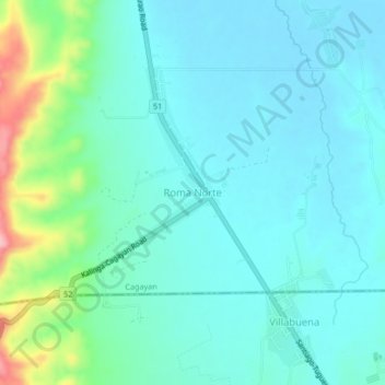
Name: Roma Norte topographic map, elevation, terrain.
Location: Roma Norte, Cagayan, Cagayan Valley, Philippines (17.50133 121.66959 17.54133 121.70959)
Average elevation: 174 ft
Minimum elevation: 69 ft
Maximum elevation: 614 ft
Make a donation
Gear up for your next adventure:
As an Amazon Associate, this site earns from qualifying purchases at no extra cost to you.
Other topographic maps
Click on a map to view its topography, its elevation and its terrain.
Fuga Island
Fuga has an area of 70 square kilometres (27 sq mi) and a population of 2,015 people. The principal settlement is Naguilian (Musa) village on the southern coast. The highest peak is Mount Nanguringan in the northeast, with an elevation of 191 metres (627 ft).
Average elevation: 30 ft
Make a donation
Gear up for your next adventure:
As an Amazon Associate, this site earns from qualifying purchases at no extra cost to you.
Dalupiri Island
Philippines > Cagayan > Calayan
Dalupiri Island lies about 45 km (28 mi) north of Luzon and about 15 km (9.3 mi) north of Fuga Island. The island has an elongated elliptical shape orientated along a north–south axis, the island has a length of about 18 km (11 mi), with a width of about 7 km (4.3 mi) at its widest point. The topography of…
Average elevation: 82 ft