
Dayuma topographic map
Click on the map to display elevation.
About this map
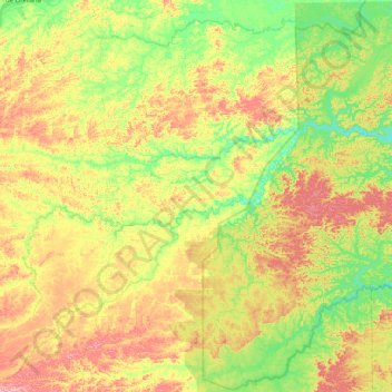
Name: Dayuma topographic map, elevation, terrain.
Location: Dayuma, Francisco de Orellana, Orellana, Ecuador (-0.91184 -77.00176 -0.49746 -76.54806)
Average elevation: 932 ft
Minimum elevation: 702 ft
Maximum elevation: 1,227 ft
Other topographic maps
Click on a map to view its topography, its elevation and its terrain.
Puerto Francisco de Orellana
Ecuador > Orellana > Francisco de Orellana > Puerto Francisco de Orellana
Average elevation: 837 ft