
Chidester topographic map
Click on the map to display elevation.
About this map
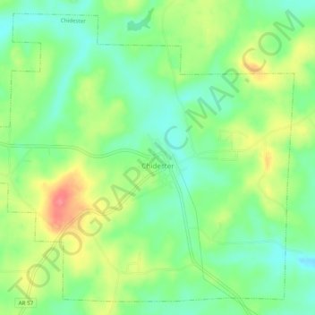
Name: Chidester topographic map, elevation, terrain.
Location: Chidester, Ouachita County, Arkansas, United States (33.68473 -93.04944 33.72177 -93.00085)
Average elevation: 276 ft
Minimum elevation: 174 ft
Maximum elevation: 427 ft
Ouachita County trails, hiking, mountain biking, running and outdoor activities
Other topographic maps
Click on a map to view its topography, its elevation and its terrain.