
Thank you for supporting this site ❤️
Make a donation
Make a donation
Gear up for your next adventure:
As an Amazon Associate, this site earns from qualifying purchases at no extra cost to you.
Dacao topographic map
Click on the map to display elevation.
Thank you for supporting this site ❤️
Make a donation
Make a donation
Gear up for your next adventure:
As an Amazon Associate, this site earns from qualifying purchases at no extra cost to you.
About this map
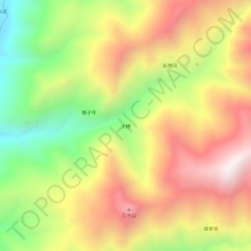
Name: Dacao topographic map, elevation, terrain.
Location: Dacao, Yongsheng County, Lijiang City, Yunnan, China (26.31285 100.66391 26.35285 100.70391)
Average elevation: 7,323 ft
Minimum elevation: 5,344 ft
Maximum elevation: 9,190 ft
Thank you for supporting this site ❤️
Make a donation
Make a donation
Gear up for your next adventure:
As an Amazon Associate, this site earns from qualifying purchases at no extra cost to you.