
Thank you for supporting this site ❤️
Make a donation
Make a donation
Gear up for your next adventure:
As an Amazon Associate, this site earns from qualifying purchases at no extra cost to you.
海嘎村 topographic map
Click on the map to display elevation.
Thank you for supporting this site ❤️
Make a donation
Make a donation
Gear up for your next adventure:
As an Amazon Associate, this site earns from qualifying purchases at no extra cost to you.
About this map
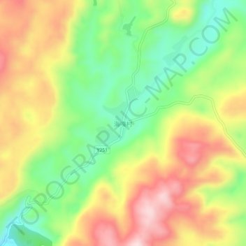
Name: 海嘎村 topographic map, elevation, terrain.
Location: 海嘎村, Kunming, Yunnan, China (25.73609 103.41396 25.77609 103.45396)
Average elevation: 7,182 ft
Minimum elevation: 6,667 ft
Maximum elevation: 7,753 ft
Thank you for supporting this site ❤️
Make a donation
Make a donation
Gear up for your next adventure:
As an Amazon Associate, this site earns from qualifying purchases at no extra cost to you.