
Požega topographic map
Interactive map
Click on the map to display elevation.
About this map
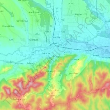
Name: Požega topographic map, elevation, terrain.
Location: Požega, Grad Požega, Požega-Slavonia County, 34000, Croatia (45.29157 17.63424 45.37157 17.71424)
Average elevation: 715 ft
Minimum elevation: 440 ft
Maximum elevation: 1,348 ft