Geolocate

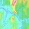
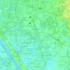
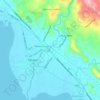
Abuyod topographic map

Click on the map to display elevation.

About this map

Name: Abuyod topographic map, elevation, terrain.

Location: Abuyod, Rizal, Calabarzon, 1879, Philippines (14.56352 121.21016 14.60352 121.25016)

Average elevation: 292 ft

Minimum elevation: 148 ft

Maximum elevation: 928 ft

Other topographic maps

Click on a map to view its topography, its elevation and its terrain.
Cainta, Rizal

Philippines > Rizal > Goldland Eastwood

Average elevation: 148 ft

Wawa Dam

Philippines > Rizal > Wawa

Average elevation: 512 ft

Talim Island

Philippines > Rizal

Average elevation: 43 ft

Muntingdilaw

Philippines > Rizal > Antipolo

Average elevation: 85 ft

Morong Plaza

Philippines > Rizal > Morong > Morong

Average elevation: 43 ft

Boso-boso River

Philippines > Rizal > Antipolo > San Joseph

Average elevation: 846 ft

Cupang

Philippines > Rizal > Antipolo

Average elevation: 157 ft

Dalig

Philippines > Rizal > Antipolo

Average elevation: 679 ft

Summer Green Subd. Phase II

Philippines > Rizal > Cainta

Average elevation: 26 ft

Bagong Nayon

Philippines > Rizal > Antipolo

Average elevation: 541 ft

Bagumbong

Philippines > Rizal > Jalajala

Average elevation: 233 ft

Bantayog ng mga Bayani

Philippines > Rizal > Cainta

Average elevation: 33 ft

Tanay River

Philippines > Rizal > Tanay

Average elevation: 108 ft

Tayabasan River

Philippines > Rizal

Average elevation: 1,316 ft

Gear up for your next adventure:

🗺️NatGeo Topo Maps - High-quality waterproof printed topographic maps of US Parks
🪶Camp Gear Gift Set - Perfect gift bundle for outdoor fans
⌚Solar GPS Watches - Advanced multisport watches with built-in topographic maps
🧴Hand Sanitizer - Keep hands clean while hiking
🛏️Cold Weather Sleeping Bag - Warm sleeping bag for cold conditions

As an Amazon Associate, this site earns from qualifying purchases at no extra cost to you.