Geolocate

Timmins topographic map

Click on the map to display elevation.

About this map

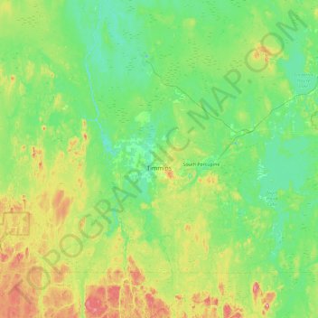
Name: Timmins topographic map, elevation, terrain.

Location: Timmins, Cochrane District, Northeastern Ontario, Ontario, Canada (48.27650 -81.72764 48.71166 -80.81142)

Average elevation: 991 ft

Minimum elevation: 850 ft

Maximum elevation: 1,421 ft

Other topographic maps

Click on a map to view its topography, its elevation and its terrain.

Bullfrog Lake

Canada > Ontario > Cochrane District > Timmins

Average elevation: 968 ft

Schumacher

Canada > Ontario > Cochrane District > Timmins

Average elevation: 1,004 ft

Whitepine Hill

Canada > Ontario > Cochrane District > Timmins

Average elevation: 961 ft

Moosonee

Canada > Ontario > Cochrane District > Moosonee

Average elevation: 23 ft

Gear up for your next adventure:

🥤Water Filter Bottle - All‑in‑one filter bottle for safe hydration
🪑Ultralight Camp Chairs - Portable seating for resting after a long day of mapping
🌧️Backpack Rain Cover - Keep gear dry in wet weather
🏕️Family Camping Gear - Essentials for group camping trips
🥘Titanium Cookware - Durable, featherlight pots and pans for backpacking

As an Amazon Associate, this site earns from qualifying purchases at no extra cost to you.