Geolocate

Lagos Island topographic map

Click on the map to display elevation.

About this map

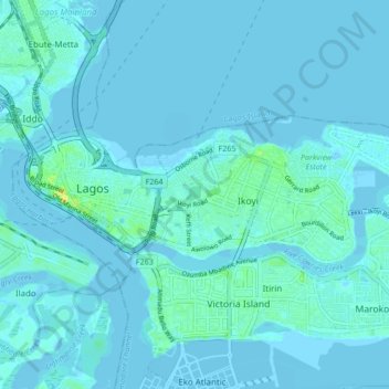
Name: Lagos Island topographic map, elevation, terrain.

Location: Lagos Island, Igbo, Eti Osa, Lagos State, Nigeria (6.43844 3.37974 6.46887 3.46420)

Average elevation: 10 ft

Minimum elevation: -16 ft

Maximum elevation: 98 ft

Gear up for your next adventure:

🛰️Handheld GPS Units - Professional satellite navigators for precise backcountry mapping
☀️Outdoor Sunscreen - High protection sunscreen for outdoor activities
🩳Quick‑Dry Hiking Shorts - Comfortable and quick‑dry shorts for summer hiking
🧺Microfiber Travel Towels - Compact and fast-drying towels for trail use
🧭GPS Watch Accessories - Bands and chargers for GPS watches

As an Amazon Associate, this site earns from qualifying purchases at no extra cost to you.