Geolocate

Ceres topographic map

Click on the map to display elevation.

About this map

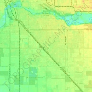
Name: Ceres topographic map, elevation, terrain.

Location: Ceres, Stanislaus County, California, United States (37.57158 -121.01190 37.62132 -120.92046)

Average elevation: 92 ft

Minimum elevation: 46 ft

Maximum elevation: 125 ft

Stanislaus County trails, hiking, mountain biking, running and outdoor activities

Other topographic maps

Click on a map to view its topography, its elevation and its terrain.

Oakdale

United States > California > Stanislaus County > Oakdale

Historically the area has been used for orchards and other agricultural uses. Some of the common soil types found in Oakdale are Delhi sand, Oakdale sandy loam, Hanford sandy loam, and Tujunga loamy sand. Oakdale is generally on level ground at an elevation of approximately 190 feet (58 m) above mean sea…

Average elevation: 217 ft

Gear up for your next adventure:

🗺️NatGeo Topo Maps - High-quality waterproof printed topographic maps of US Parks
🧯Emergency Survival Kit - All‑in‑one survival essentials for the backcountry
🧦Merino Wool Socks - Moisture-wicking, blister-preventing socks for long treks
☀️Outdoor Sunscreen - High protection sunscreen for outdoor activities
🪶LED Camping Lantern - Bright lantern for camp lighting

As an Amazon Associate, this site earns from qualifying purchases at no extra cost to you.