
Howardsville topographic map
Click on the map to display elevation.
About this map
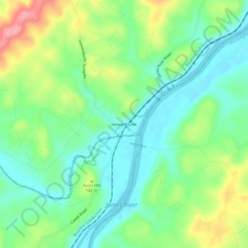
Name: Howardsville topographic map, elevation, terrain.
Average elevation: 420 ft
Minimum elevation: 289 ft
Maximum elevation: 679 ft
Albemarle County trails, hiking, mountain biking, running and outdoor activities
Other topographic maps
Click on a map to view its topography, its elevation and its terrain.
Darden Towe Park
United States > Virginia > Albemarle County > Charlottesville > Franklin
Average elevation: 423 ft
Beaver Creek Park
United States > Virginia > Albemarle County > Charlottesville > Wickham Pond
Average elevation: 607 ft