
Thank you for supporting this site ❤️
Make a donation
Make a donation
Gear up for your next adventure:
As an Amazon Associate, this site earns from qualifying purchases at no extra cost to you.
Minamiishidocho topographic map
Click on the map to display elevation.
Thank you for supporting this site ❤️
Make a donation
Make a donation
Gear up for your next adventure:
As an Amazon Associate, this site earns from qualifying purchases at no extra cost to you.
About this map
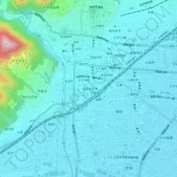
Name: Minamiishidocho topographic map, elevation, terrain.
Location: Minamiishidocho, Nagano, Nagano Prefecture, 380-0824, Japan (36.62426 138.16610 36.66426 138.20610)
Average elevation: 1,276 ft
Minimum elevation: 1,125 ft
Maximum elevation: 2,500 ft
Thank you for supporting this site ❤️
Make a donation
Make a donation
Gear up for your next adventure:
As an Amazon Associate, this site earns from qualifying purchases at no extra cost to you.