
Thank you for supporting this site ❤️
Make a donation
Make a donation
Gear up for your next adventure:
As an Amazon Associate, this site earns from qualifying purchases at no extra cost to you.
Sapinhaut topographic map
Click on the map to display elevation.
Thank you for supporting this site ❤️
Make a donation
Make a donation
Gear up for your next adventure:
As an Amazon Associate, this site earns from qualifying purchases at no extra cost to you.
About this map
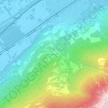
Name: Sapinhaut topographic map, elevation, terrain.
Location: Sapinhaut, Saxon, Martigny, Valais, 1907, Suisse (46.11441 7.15197 46.15441 7.19197)
Average elevation: 3,100 ft
Minimum elevation: 1,509 ft
Maximum elevation: 7,943 ft
Thank you for supporting this site ❤️
Make a donation
Make a donation
Gear up for your next adventure:
As an Amazon Associate, this site earns from qualifying purchases at no extra cost to you.