
Thank you for supporting this site ❤️
Make a donation
Make a donation
Gear up for your next adventure:
As an Amazon Associate, this site earns from qualifying purchases at no extra cost to you.
Imbabura topographic map
Click on the map to display elevation.
Thank you for supporting this site ❤️
Make a donation
Make a donation
Gear up for your next adventure:
As an Amazon Associate, this site earns from qualifying purchases at no extra cost to you.
About this map
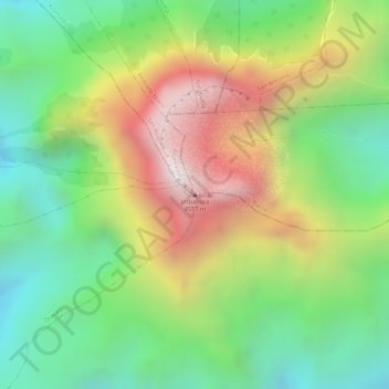
Name: Imbabura topographic map, elevation, terrain.
Location: Imbabura, La Esperanza, Ibarra, Imbabura, Ecuador (0.25424 -78.18044 0.25434 -78.18034)
Average elevation: 13,310 ft
Minimum elevation: 12,005 ft
Maximum elevation: 14,993 ft
Thank you for supporting this site ❤️
Make a donation
Make a donation
Gear up for your next adventure:
As an Amazon Associate, this site earns from qualifying purchases at no extra cost to you.