
Thank you for supporting this site ❤️
Make a donation
Make a donation
Gear up for your next adventure:
As an Amazon Associate, this site earns from qualifying purchases at no extra cost to you.
Punta Vergajo topographic map
Click on the map to display elevation.
Thank you for supporting this site ❤️
Make a donation
Make a donation
Gear up for your next adventure:
As an Amazon Associate, this site earns from qualifying purchases at no extra cost to you.
About this map
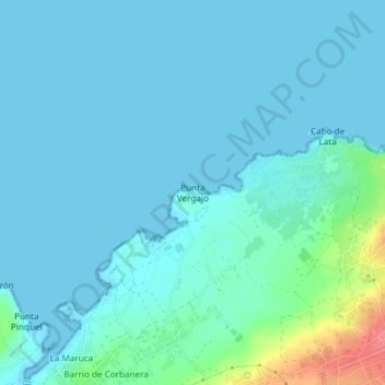
Name: Punta Vergajo topographic map, elevation, terrain.
Location: Punta Vergajo, Santander, Cantabria, 39012, España (43.49027 -3.82447 43.49037 -3.82437)
Average elevation: 33 ft
Minimum elevation: -3 ft
Maximum elevation: 233 ft
Thank you for supporting this site ❤️
Make a donation
Make a donation
Gear up for your next adventure:
As an Amazon Associate, this site earns from qualifying purchases at no extra cost to you.
Other topographic maps
Click on a map to view its topography, its elevation and its terrain.
Isla de la Virgen del Mar
España > Cantabria > Santander > San Román de la Llanilla > El Rostrío
Average elevation: 26 ft