Geolocate

Gateway topographic map

Click on the map to display elevation.

About this map

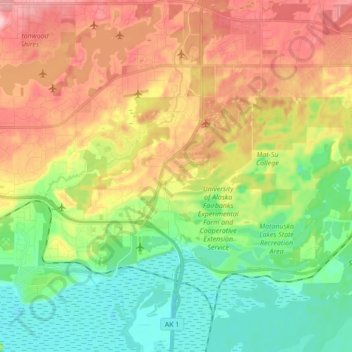
Name: Gateway topographic map, elevation, terrain.

Location: Gateway, Matanuska-Susitna Borough, Alaska, United States (61.53261 -149.34501 61.61459 -149.17257)

Average elevation: 210 ft

Minimum elevation: 0 ft

Maximum elevation: 492 ft

Matanuska-Susitna Borough trails, hiking, mountain biking, running and outdoor activities

Gear up for your next adventure:

🧴Hand Sanitizer - Keep hands clean while hiking
🕶️GPS Smartphone Mount - Secure mount for phone navigation
🧼Biodegradable Camping Soap - Eco‑friendly soap for outdoor hygiene
📦Dry Bags Set - Waterproof storage for electronics and clothes
🎒Hydration Pack - Hands‑free water reservoir for long hikes

As an Amazon Associate, this site earns from qualifying purchases at no extra cost to you.