Geolocate

water topographic map

Click on the map to display elevation.

About this map

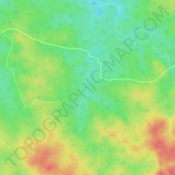
Name: water topographic map, elevation, terrain.

Location: water, Sohagpur Tahsil, Shahdol, Madhya Pradesh, India (23.55424 81.51364 23.59492 81.52945)

Average elevation: 1,644 ft

Minimum elevation: 1,545 ft

Maximum elevation: 1,765 ft

Gear up for your next adventure:

🛠️Outdoor Gear Repair Kit - Essential tools to fix gear on the trail
🔦Compact Flashlight - Reliable flashlight for emergencies
🔌Solar Panel Charger - Charge gear sustainably outdoors
📦Dry Bags Set - Waterproof storage for electronics and clothes
🔥Plasma Lighters - Windproof lighters that work in any weather condition

As an Amazon Associate, this site earns from qualifying purchases at no extra cost to you.