
Thank you for supporting this site ❤️
Make a donation
Make a donation
Gear up for your next adventure:
As an Amazon Associate, this site earns from qualifying purchases at no extra cost to you.
Kabia topographic map
Click on the map to display elevation.
Thank you for supporting this site ❤️
Make a donation
Make a donation
Gear up for your next adventure:
As an Amazon Associate, this site earns from qualifying purchases at no extra cost to you.
About this map
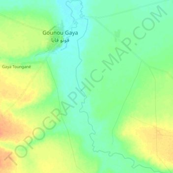
Name: Kabia topographic map, elevation, terrain.
Location: Kabia, Gounou Gaya, Mayo-Kebbi Est, Chad (9.51466 15.52274 9.66233 15.60045)
Average elevation: 1,145 ft
Minimum elevation: 1,106 ft
Maximum elevation: 1,204 ft
Thank you for supporting this site ❤️
Make a donation
Make a donation
Gear up for your next adventure:
As an Amazon Associate, this site earns from qualifying purchases at no extra cost to you.