
Thank you for supporting this site ❤️
Make a donation
Make a donation
Gear up for your next adventure:
As an Amazon Associate, this site earns from qualifying purchases at no extra cost to you.
Cubantia topographic map
Click on the map to display elevation.
Thank you for supporting this site ❤️
Make a donation
Make a donation
Gear up for your next adventure:
As an Amazon Associate, this site earns from qualifying purchases at no extra cost to you.
About this map
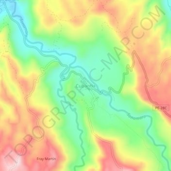
Name: Cubantia topographic map, elevation, terrain.
Location: Cubantia, Pangoa, Satipo, Junín, Perú (-11.59990 -74.42772 -11.55990 -74.38772)
Average elevation: 3,146 ft
Minimum elevation: 2,651 ft
Maximum elevation: 3,704 ft
Thank you for supporting this site ❤️
Make a donation
Make a donation
Gear up for your next adventure:
As an Amazon Associate, this site earns from qualifying purchases at no extra cost to you.