
Thank you for supporting this site ❤️
Make a donation
Make a donation
Gear up for your next adventure:
As an Amazon Associate, this site earns from qualifying purchases at no extra cost to you.
Tyresta topographic map
Click on the map to display elevation.
Thank you for supporting this site ❤️
Make a donation
Make a donation
Gear up for your next adventure:
As an Amazon Associate, this site earns from qualifying purchases at no extra cost to you.
About this map
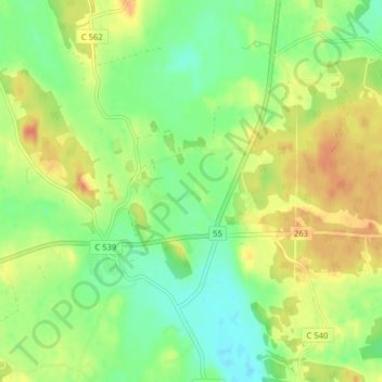
Name: Tyresta topographic map, elevation, terrain.
Location: Tyresta, Enköpings kommun, Uppsala län, 749 52, 瑞典 (59.64633 17.23984 59.68633 17.27984)
Average elevation: 82 ft
Minimum elevation: 20 ft
Maximum elevation: 151 ft
Thank you for supporting this site ❤️
Make a donation
Make a donation
Gear up for your next adventure:
As an Amazon Associate, this site earns from qualifying purchases at no extra cost to you.