Geolocate

Bretherton topographic map

Click on the map to display elevation.

About this map

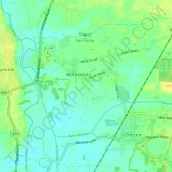
Name: Bretherton topographic map, elevation, terrain.

Location: Bretherton, Chorley, Lancashire, England, United Kingdom (53.65723 -2.82425 53.69289 -2.74817)

Average elevation: 33 ft

Minimum elevation: 7 ft

Maximum elevation: 85 ft

Gear up for your next adventure:

🧦Hiking Socks - Comfortable socks to prevent blisters on long hikes
🥾Hiking Shoes - Durable and comfortable shoes for trail hiking
🍳Camping Cook Set - Complete cookware for outdoor meals
🪶Thermal Camp Blanket - Extra warmth for cold nights
🥾Men's Hiking Boots - Durable, waterproof footwear for rugged terrain and steep inclines

As an Amazon Associate, this site earns from qualifying purchases at no extra cost to you.