
Thank you for supporting this site ❤️
Make a donation
Make a donation
Gear up for your next adventure:
As an Amazon Associate, this site earns from qualifying purchases at no extra cost to you.
Qingshui River topographic map
Click on the map to display elevation.
Thank you for supporting this site ❤️
Make a donation
Make a donation
Gear up for your next adventure:
As an Amazon Associate, this site earns from qualifying purchases at no extra cost to you.
About this map
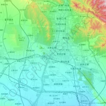
Name: Qingshui River topographic map, elevation, terrain.
Location: Qingshui River, 闫家屯村, Zhangjiakou City, Hebei, 075000, China (40.68140 114.81921 40.84548 114.89061)
Average elevation: 2,562 ft
Minimum elevation: 2,116 ft
Maximum elevation: 4,685 ft
Thank you for supporting this site ❤️
Make a donation
Make a donation
Gear up for your next adventure:
As an Amazon Associate, this site earns from qualifying purchases at no extra cost to you.