
Make a donation
Gear up for your next adventure:
As an Amazon Associate, this site earns from qualifying purchases at no extra cost to you.
Halingen topographic map
Click on the map to display elevation.
Make a donation
Gear up for your next adventure:
As an Amazon Associate, this site earns from qualifying purchases at no extra cost to you.
Halingen
Das Wappen der ehemaligen Gemeinde Halingen enthält – wie alle Wappen des Amtes Menden – ein „Kuheisen“, über dem, auf silbernem Grund, eine schwarze „Feuersäge“ dargestellt ist, welche für die Höhenregulierung eines Topfes über der offenen Feuerstelle nötig war. Die niederdeutsche Bezeichnung für eine solche Feuersäge ist „Haal“ oder „Hoal“. Daher stammt die Verbindung zum Namen des Dorfes.
Make a donation
Gear up for your next adventure:
As an Amazon Associate, this site earns from qualifying purchases at no extra cost to you.
About this map
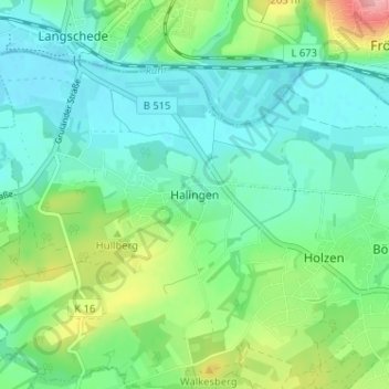
Name: Halingen topographic map, elevation, terrain.
Average elevation: 482 ft
Minimum elevation: 381 ft
Maximum elevation: 761 ft
Make a donation
Gear up for your next adventure:
As an Amazon Associate, this site earns from qualifying purchases at no extra cost to you.
Other topographic maps
Click on a map to view its topography, its elevation and its terrain.
58708
Deutschland > Nordrhein-Westfalen > Märkischer Kreis > Menden (Sauerland) > Oberoesbern
Average elevation: 728 ft
58710
Deutschland > Nordrhein-Westfalen > Märkischer Kreis > Menden (Sauerland)
Average elevation: 676 ft