Carora topographic map
Interactive map
Click on the map to display elevation.
About this map
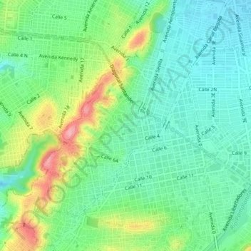
Name: Carora topographic map, elevation, terrain.
Location: Carora, Cúcuta, Oriental, Norte de Santander, 540006, Colombia (7.87445 -72.53109 7.91445 -72.49109)
Average elevation: 1,070 ft
Minimum elevation: 932 ft
Maximum elevation: 1,362 ft
Other topographic maps
Click on a map to view its topography, its elevation and its terrain.
Cúcuta
Colombia > Norte de Santander > Cúcuta
Cúcuta, Norte de Santander, 047, Colombia
Average elevation: 1,886 ft
Los olivos
Colombia > Norte de Santander > Cúcuta
Los olivos, Cúcuta, Norte de Santander, 540013, Colombia
Average elevation: 942 ft