Geolocate

Atlas topographic map

Click on the map to display elevation.

About this map

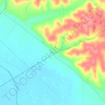
Name: Atlas topographic map, elevation, terrain.

Location: Atlas, Pike County, Illinois, 62370, United States (39.49394 -90.98958 39.53394 -90.94958)

Average elevation: 541 ft

Minimum elevation: 436 ft

Maximum elevation: 748 ft

Pike County trails, hiking, mountain biking, running and outdoor activities

Other topographic maps

Click on a map to view its topography, its elevation and its terrain.

New Salem

United States > Illinois > Pike County

Average elevation: 771 ft

Hull

United States > Illinois > Pike County

Average elevation: 466 ft

Nebo

United States > Illinois > Pike County

Average elevation: 538 ft

Barry

United States > Illinois > Pike County

Average elevation: 705 ft

New Salem

United States > Illinois > Pike County

Average elevation: 771 ft

Gear up for your next adventure:

🩹Survival Bandages - High‑quality bandages for emergencies
🎁Geography Themed Gifts - Unique gift ideas for map lovers and geography enthusiasts
📷Action Cameras - Rugged cameras to document your journeys across rugged terrain
🎒Trekking Poles - Sturdy poles for balance and stability on rough terrain
☀️Outdoor Sunscreen - High protection sunscreen for outdoor activities

As an Amazon Associate, this site earns from qualifying purchases at no extra cost to you.