
鄱阳湖 topographic map
Interactive map
Click on the map to display elevation.
About this map
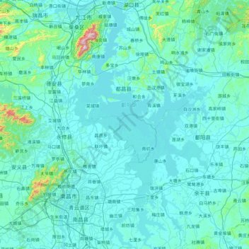
Name: 鄱阳湖 topographic map, elevation, terrain.
Location: 鄱阳湖, 永修县, 九江市, 江西省, 中国 (28.39404 115.84534 29.75551 116.76391)
Average elevation: 203 ft
Minimum elevation: 20 ft
Maximum elevation: 4,672 ft
“高水是湖,低水似河”是鄱阳湖的特征。湖底水道高程自南向北渐降,由海拔12米降至湖口约1米,鞋山附近为-1米,褚溪口低达-2米。
Other topographic maps
Click on a map to view its topography, its elevation and its terrain.