
Thank you for supporting this site ❤️
Make a donation
Make a donation
Gear up for your next adventure:
As an Amazon Associate, this site earns from qualifying purchases at no extra cost to you.
Tecama topographic map
Click on the map to display elevation.
Thank you for supporting this site ❤️
Make a donation
Make a donation
Gear up for your next adventure:
As an Amazon Associate, this site earns from qualifying purchases at no extra cost to you.
About this map
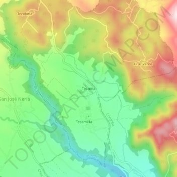
Name: Tecama topographic map, elevation, terrain.
Location: Tecama, Tomatlán, Veracruz, 94179, México (18.98389 -97.00528 19.02389 -96.96528)
Average elevation: 4,117 ft
Minimum elevation: 3,504 ft
Maximum elevation: 4,961 ft
Thank you for supporting this site ❤️
Make a donation
Make a donation
Gear up for your next adventure:
As an Amazon Associate, this site earns from qualifying purchases at no extra cost to you.